• Welcome to your new Gnomio site

    Now, you are in control!

    Moodle is an open-source Learning Management System (LMS) that provides educators with the tools and features to create and manage online courses. It allows educators to organize course materials, create quizzes and assignments, host discussion forums, and track student progress. Moodle is highly flexible and can be customized to meet the specific needs of different institutions and learning environments.

    Moodle supports both synchronous and asynchronous learning environments, enabling educators to host live webinars, video conferences, and chat sessions, as well as providing a variety of tools that support self-paced learning, including videos, interactive quizzes, and discussion forums. The platform also integrates with other tools and systems, such as Google Apps and plagiarism detection software, to provide a seamless learning experience.

    Moodle is widely used in educational institutions, including universities, K-12 schools, and corporate training programs. It is well-suited to online and blended learning environments and distance education programs. Additionally, Moodle's accessibility features make it a popular choice for learners with disabilities, ensuring that courses are inclusive and accessible to all learners.

    The Moodle community is an active group of users, developers, and educators who contribute to the platform's development and improvement. The community provides support, resources, and documentation for users, as well as a forum for sharing ideas and best practices. Moodle releases regular updates and improvements, ensuring that the platform remains up-to-date with the latest technologies and best practices.

    Links of interest:

    (You can edit or remove this text)

Available courses

Land law is a branch of law that governs the rights, interests, and responsibilities related to land and real property. It defines how land is owned, used, transferred, leased, or inherited. Land law is fundamental in regulating relationships between individuals, the community, and the state concerning land ownership and use.

Land law covers a wide range of legal principles and topics, including:

Ownership rights (who can own land and under what conditions)

Tenure systems (freehold, leasehold, customary tenure, etc.)

Land registration (recording of land titles and transactions)

Transfers and conveyancing (sale, gift, inheritance, or mortgage of land)

Leases and tenancies (landlord-tenant relationships)

Easements and encumbrances (rights of way, utility access, etc.)

Zoning and land use (regulations on how land can be used)

One of the key objectives of land law is to ensure legal certainty and protect property rights, while also balancing public interest, such as environmental protection, urban planning, and social justice.

In many countries, land law consists of a mix of:

Statutory law (laws enacted by the government)

Common law or case law (judicial decisions)

Customary law (traditional practices, especially in rural or indigenous communities)

Land law also plays a crucial role in:

Resolving disputes over boundaries or ownership

Regulating land development and urban planning

Enabling land reforms and redistribution

Facilitating invest

ment in real estate and infrastructure

A cadastral survey is a type of land survey conducted to establish and record the boundaries, dimensions, and ownership of land parcels. It plays a critical role in land administration by defining legal property lines and supporting land registration, ownership transfer, taxation, and dispute resolution.

The primary purpose of a cadastral survey is to determine the exact limits of land ownership and to create official records that are recognized by law. These records include cadastral maps and land titles, which provide essential information such as plot size, boundary coordinates, and ownership details.

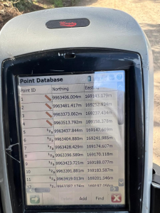
Cadastral surveys are usually carried out by licensed surveyors using specialized instruments like total stations, GPS, and levels. The process includes field measurements, verification of existing boundaries, setting up boundary markers, and preparing detailed maps and reports. These documents are submitted to land administration or cadastral offices for legal recognition and storage in a land registry.

There are two main types of cadastral surveys:

1. Original Cadastral Survey – Done for unregistered land to define its boundaries for the first time.

2. Re-survey or Re-establishment Survey – Done to verify, adjust, or update existing property boundaries.

Modern cadastral systems often use GIS (Geographic Information Systems) and digital databases to store, manage, and update land records. This integration supports faster decision-making in urban planning, infrastructure development, and public land management.

In summary, cadastral surveys are essential for:

Defining legal property boundaries

Supporting land registration and title issuance

Enabling fair land taxation

Preventing boundary disputes and land fraud

Assisting in lan

d development and planning

An engineering survey is a type of survey conducted to gather data essential for the planning, design, construction, and maintenance of engineering projects. These projects can include roads, bridges, buildings, pipelines, and other infrastructure.

Engineering Survey Description

An engineering survey involves the precise measurement and mapping of features on or near the Earth's surface to support engineering work. It includes a range of specialized activities such as topographic surveys, construction layout, alignment surveys, and deformation monitoring. The purpose is to collect reliable data on elevations, distances, angles, and positions to ensure accuracy in the design and construction phases of a project.

Key Components

1. Reconnaissance Survey – Preliminary investigation to gather general site data.

2. Preliminary Survey – Provides detailed data for planning and estimating.

3. Location Survey – Determines the exact location and alignment of a project.

4. Construction Survey – Guides construction work with layout and benchmarks.

5. As-built Survey – Records the actual position of constructed structures.

6. Monitoring Survey – Tracks movement or deformation over time.

Applications

Route alignment for roads and railways

Site layout for buildings and utilities

Earthwork volume calculations

Structural deformation monitoring

Setting out construction work

Instruments and Techniques

Total stations

GPS/GNSS

Levels

Dr

ones for aerial mapping

Laser scanning (LiDAR)

Welcome to Land Surveying